There is an increasing awareness that natural solutions can be effective tools to counteract or mitigate problems caused by climate change and an intensive land use system. Nowadays, a crucial challenge for farmers is the occurrence of floods and drought, sometimes even on the same field. Agroforestry is a natural way to reduce runoff risks and outweigh drought – either as standalone method or in combination with other tools such as swales and vegetation strips. Several studies show the potential of agroforestry to contribute to water management (AWM). However, the knowledge on how agroforestry can work as AWM is still very limited, in particular for temperate regions. Therefore, and further investigation on farms or experimental sites are required.
Within the AFaktive project, hydrological data are currently being collected on 6 pioneer and one pilot agroforestry sites in Germany, the Netherlands and Belgium. In AFaktive, pioneer sites, refer to well established agroforestry fields (age 3 up to 12 years), while pilot sites refer to fields where the trees were either planted recently or will be planted within the project period. Further, four agroforestry sites still to be established and two more pioneer sites are planned and will be monitored from 2026 onwards. In the following, a project site map.
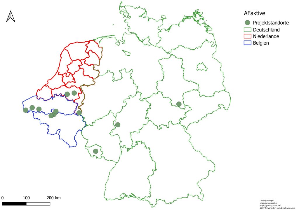
Finally, the AFaktive hydrological monitoring network will comprise 12 different agroforestry sites in various regions of Germany, the Netherlands and Belgium. This comprehensive monitoring set-up can be managed thanks to telemetry and the effort of 7 project partners. On each site, the telemetric recording will run from 2025 or 2026 up to 2033, which is 5 years beyond the project end. Equipped with a weather station or a rain-gauge as well as several transects of soil humidity sensors along a water flow path across a tree strip, the monitoring sites will provide data that can help understand how AWM can be effective.
For knowledge gain, the data will be first of all used for modelling runoff, infiltration and the estimation of plant water availability – all as being influenced by a tree strip. To improve the modelling predictions, manual measurements on infiltration (top soil layer) and hydraulic conductivity (at 35 cm soil depth) will be taken twice a year, i.e. during a dry and a wet period from 2026 onwards. Each time, measurements on the influence in tree strip and outside the tree strip will be compared. First test measurements have been conducted on a German pioneer site.
Results will follow.